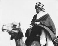
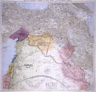
Map.

This is coolbert:
Another interesting program on National Public Radio [NPR] this afternoon.
Describes a "long lost map" drawn by the great T.E. Lawrence at the end of World War One.
Lawrence's suggestion as to how the Middle East was to be divided into nation-states from the lands of the defeated Ottoman Empire. This map was not "lost" but actually mis-dated and accidentally rediscovered.
"A new exhibition at London's Imperial War Museum features a long-lost map of the Middle East drafted by Lawrence and presented to the British cabinet in 1918. It provides an alternative to present-day borders in the region, taking into account local Arab sensibilities rather than the European colonial considerations that were dominant at the time.
For historians, Lawrence's map is an exercise in what ifs: He included a separate state for the Kurds, similar to that demanded by Iraq's Kurds today. Lawrence groups together the people in present-day Syria, Jordan and parts of Saudi Arabia into another state based on tribal patterns and commercial routes.
The map also envisions a separate state called Palestine -- Lawrence knew the British were considering the creation of a homeland for the Jews.
And he saw no reason to separate Iraq's Sunnis and the Shiites -- an issue that continues to divide that country today."

See the entire story [and other stories concerning Lawrence] by clicking here.
coolbert.

0 Comments:
Post a Comment
Subscribe to Post Comments [Atom]
<< Home